Projects

Research projects

Applying AI, quantum computing, and wireless systems to real-world challenges.

6 projects

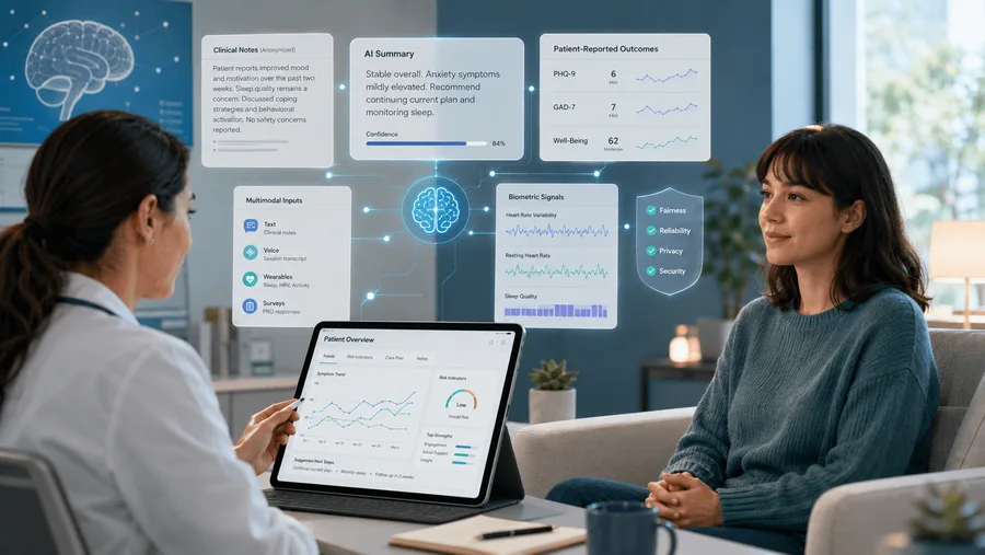
Overview of AI and machine learning pipelines for measurement-based mental health care

Artificial Intelligence

Mitacs Research Project: AI/ML Development for Measurement-Based Mental Health Care

A Mitacs project, in collaboration with Kelello Health and CAMH, building models and data pipelines for clinical assessment, patient monitoring, and decision support.

Approach and application

This Mitacs project develops AI and machine learning solutions to support measurement-based care in mental health applications. In collaboration with Kelello Health and CAMH, the project aims to build intelligent models and data-driven pipelines for clinical assessment, patient monitoring, and decision support.

By integrating large language models, multimodal learning, and robust predictive analytics, the work explores how heterogeneous healthcare data, including structured clinical records, patient-reported outcomes, and text-based information, can be transformed into actionable insights. The project emphasizes fairness, reliability, and real-world deployment.

Project partners

  • Mitacs
  • Kelello Health
  • CAMH
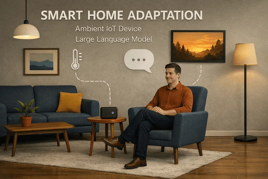
Concept illustration of the EchoMate assistant adjusting home devices in response to a user’s voice

Artificial Intelligence

Smart Home – Emotion-Aware and Contextual Personal Assistant

EchoMate, a smart-home assistant built on large language models and integrated with HomeAssistant, interprets what users say and how they say it.

Approach and application

Traditional smart home systems often rely on predefined rules or basic machine learning models, which struggle to adapt to natural human communication and emotional nuance. EchoMate is a smart home assistant powered by large language models (LLMs) and integrated with HomeAssistant, enabling natural conversation with users.

EchoMate detects emotional cues from voice and adjusts home devices such as lighting, temperature, or music accordingly. For example, if someone sounds stressed, EchoMate may suggest a break and create a soothing environment. The project page reports that pilot users expressed high satisfaction with its personalized responses.

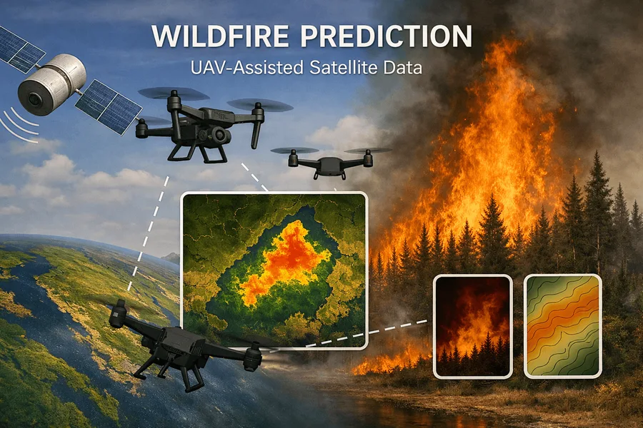
Concept illustration of UAVs and satellites monitoring a forested region for early wildfire signs

Artificial Intelligence

Wildfire Early Detection – UAV-Satellite Forecasting System

UAVs collect localized multimodal data to complement satellite observations, with lightweight models on board and heavier processing at a control center.

Approach and application

Many fire-prone areas, especially remote boreal zones, lack adequate ground-based sensing or rapid-response systems. This project combines unmanned aerial vehicles (UAVs) with satellite and environmental data. UAVs act as mobile surveillance units that reach regions where human deployment is impractical and autonomously collect localized multimodal data.

To accommodate limited onboard resources, a collaborative AI deployment strategy runs lightweight model components on the UAVs while more intensive processing is handled by the control center. A dynamic database at the control center supports continuous model updating as wildfire patterns evolve, with the aim of supporting early intervention and reducing response times.

Related research

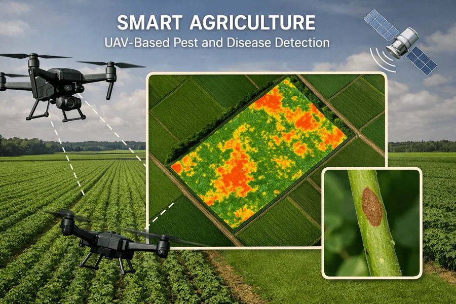
Concept illustration of a UAV surveying crop rows to detect pests and disease

Artificial Intelligence

Smart Agriculture – UAV-Based Pest & Disease Detection

An autonomous UAV system that surveys fields at scale and uses onboard vision to identify pests, diseases, and weeds down to the plant level.

Approach and application

Conventional pest scouting covers only a small fraction of fields, leaving blind spots that drive crop losses and pesticide overuse. This project developed an autonomous UAV-based system that surveys fields and detects early signs of crop threats using onboard vision and intelligence.

By combining high-resolution aerial imagery with AI models, the system identifies pests, diseases, and weeds down to the plant level. The project page reports field pilots in which inspection time per acre fell from hours to minutes, with up to 30% reduction in pesticide usage and 20% yield improvement.

Related research

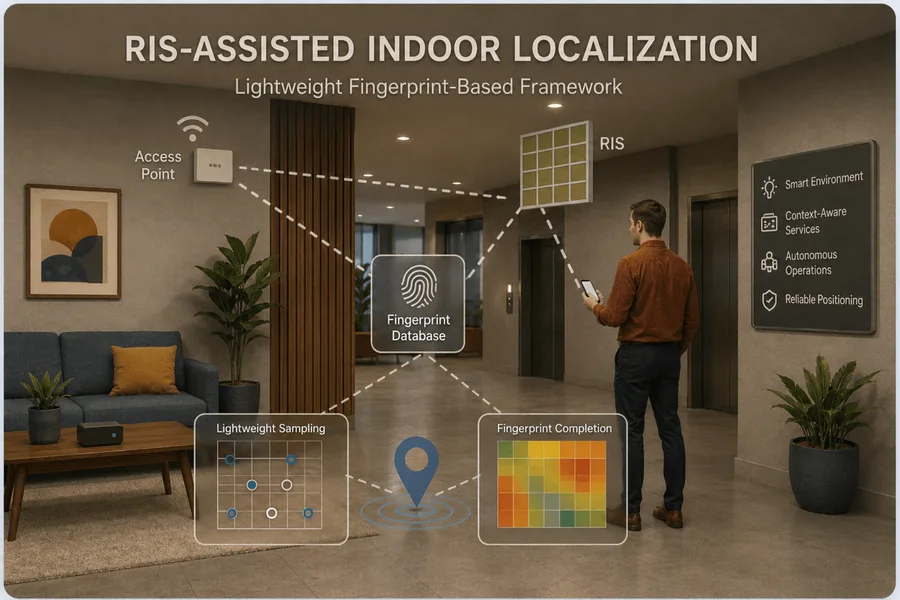
Indoor localization setup in which a reconfigurable intelligent surface shapes wireless responses at nearby locations

Wireless Communication

Lightweight RIS-assisted Localization for Indoor Intelligent Wireless Systems

A lightweight fingerprint-based framework that uses a small number of configurable RIS patterns to locate devices indoors, where GPS is unavailable.

Approach and application

Accurate indoor localization is increasingly important for intelligent wireless systems, as smart environments, context-aware services, and autonomous indoor operations rely on reliable position information. Indoor localization remains challenging due to severe multipath propagation, blockage, dynamic obstacles, and the absence of GPS coverage.

This project investigates how reconfigurable intelligent surfaces (RISs) can enable practical and efficient indoor localization. Instead of relying on explicit path separation or high-complexity geometric parameter estimation, it adopts a lightweight fingerprint-based framework that directly exploits location-dependent wireless responses under a small number of configurable RIS patterns.

The research focuses on improving fingerprint discriminability among nearby locations and reducing offline radio-map construction cost through lightweight sampling and completion methods.

Related research

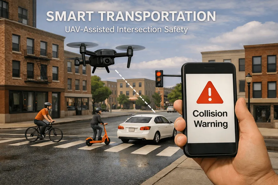
Concept illustration of UAVs and roadside units monitoring an urban intersection with mixed traffic

Wireless Communication

Smart Transportation – UAV-Assisted Intersection Safety System

With Beware Company: UAVs as aerial surveillance nodes, roadside units as edge servers, and semantic transmission of only task-critical information.

Approach and application

Urban intersections are high-risk zones, particularly with mixed mobility such as bicycles, scooters, and lightweight vehicles. In partnership with Beware Company, the project is developing a 3D smart transportation system based on UAV-assisted surveillance.

UAVs create a real-time view of intersection activity and collaborate with roadside traffic units acting as edge servers for low-latency processing. A semantic transmission method shares only task-critical information instead of raw streams. When potential collision risks are detected, alerts are sent to users’ smartphones.

Project partners

  • Beware Company

Related research